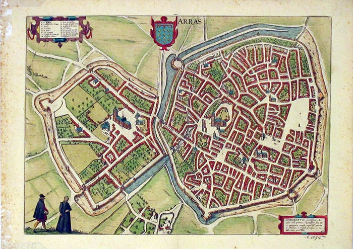
Map of Arras, France, from Civitates Orbis Terrarum
Cologne: Coloniae Agrippinae, 1575.
First printing. 21.5 x 15.5, hand-colored map. Scattered foxing in margins, not affecting image; pencil notations from previous owner and tape remants to corners on reverse. In very good condition, with strong color. Item #3789
Plate 22 from the second volume of Braun and Hogenberg's celebrated atlas of cities of the world -- the second modern atlas, following (and modeled on) Theatrum Orbis Terrarum of Ortelius. Noted, among other things, for the varied views of cities of Europe, and for the information about costume revealed in the small portraits at the bottom of many of the maps. Printed on the reverse of the recto half of the image is Braun's text describing the city of Arras. The hand-coloring, while following a consistent general plan, varies among copies and editions; in this copy, for example, the waterway surrounding the city is blue for only half its course, whether due to the colorist's whim (or inattention), or possibly to the conditions at the time of execution? An intriguing question for historical inquiry, perhaps.
Price: $250.00